October 17, 2025-
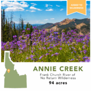
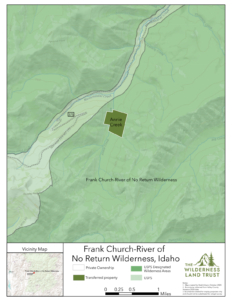
The Payette Land Trust and Wilderness Land Trust partnered to purchase a 94-acre private inholding within Idaho’s Frank Church River of No Return Wilderness in August 2024, safeguarding Annie Creek from development. This property was recently transferred into public ownership, adding it to the designated wilderness area.
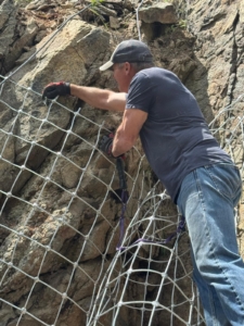
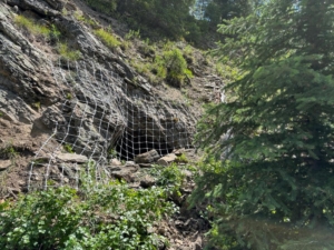
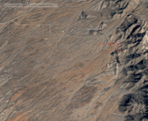
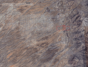
The Annie Creek property is located near the western edge of the wilderness area, approximately 40 miles from McCall, Idaho. Surrounded by the steep, forested terrain characteristic of the Frank Church, the property includes gentler slopes, creeks, wetlands, and flat building sites, which were used in the early 1900s during Idaho’s mining boom. Located near a well-maintained road, the property was particularly vulnerable to development. Private inholdings within designated wilderness areas carry none of the protections of the surrounding wilderness and can be developed with cabins, resorts, or even industrial sites. The threat of development was removed when the two land trusts, with generous support from the Leuthold Foundation, purchased the inholding from a private owner. Now in public hands, Annie Creek will enjoy the highest level of protection available to public lands as designated wilderness, which can only be altered by an act of Congress, not through executive order or administration directive.
At 2.3 million acres, the Frank Church River of No Return Wilderness is the largest wilderness area in the lower 48 states and is home to over 180 miles of the free-flowing Salmon River. Its large, connected habitats are rich in biodiversity with over 280 species of mammals, fish, birds, reptiles, and amphibians. The addition of the Annie Creek property to the wilderness area will help protect important wildlife habitat and strengthen connectivity across the landscape.
“Idaho is changing at a rapid rate which requires voluntary partnerships between private landowners, organizations and foundations to conserve Idaho’s natural beauty. We are proud to work with The Wilderness Land Trust and the Leuthold Foundation to conserve this unique landscape into the future”
-Payette Land Trust Executive Director, Craig Utter
“Thanks to our partnerships with the Payette Land Trust and the Leuthold Foundation, this special place will be protected for future generations to enjoy in one of America’s most iconic wilderness areas”
-The Wilderness Land Trust President, Brad Borst
In the organization’s 33-year history, The Wilderness Land Trust has worked to keep the promise of wilderness by acquiring these private inholdings from willing landowners and transferring them to federal ownership to become designated wilderness. In this time, the Trust has purchased and transferred 614 properties totaling over 59,000 acres from Arizona to Alaska, completing 18 wilderness areas by removing their last remaining private inholdings. With each transfer, we come one step closer to completing the vision of the Wilderness Act. Learn more at www.wildernesslandtrust.org.
Payette Land Trust (PLT) works to conserve the wild and working lands of West Central Idaho by partnering with private landowners, communities, and conservation organizations to balance conservation and development. PLT currently owns or holds conservation easements on 21 properties totaling 3,891 acres across Adams, Idaho, Valley, and Washington counties. Through projects like the Annie Creek partnership, PLT advances its mission of voluntary, community-based conservation for the benefit of current and future generations. Learn more at www.payettelandtrust.org.