Wilderness Land Trust
  • ABOUT
    • Our Mission
    • Our Story
    • Our Staff
    • Our Board
    • Join Our Team
    • Newsletters
    • Annual Reports & Financials
  • HOW WE WORK
    • Our Process
    • Stories
    • Landowners
    • Videos
    • Wilderness Book Club
  • NEWS
    • Recent News
    • Press
  • PROJECTS
    • Projects by State
  • GET INVOLVED
    • Donate
    • Ways to Give
    • Support a Project
  • CONTACT US
  • Donate Now
  • Click to open the search input field Click to open the search input field Search
  • Menu Menu

Mapping threats to the wilderness you love

July 12, 2024-

When we set out last year to begin creating a first of its kind GIS-based national inventory of private properties in and around wilderness, we knew we’d need help. We knew what the challenges of our current, largely analog system of inventorying wilderness inholdings are, we knew what we were hoping to accomplish with the help of this new GIS tool, but we only had a passing knowledge of the GIS technology itself. So, we began engaging with experts in the field to understand what resources were already out there and how we might go about carrying out this ambitious project. As is often the case when you have limited knowledge and are talking to someone with vast knowledge, it can be hard to know what you don’t know, and even to know what the right questions to ask are, let alone the right terms to use in asking.

In discussing where to begin, Brad, our President, mentioned “You know, I’ve met one of our supporters in Washington named Stu Smith who is a retired GIS professional. He might be willing to talk with us to answer some questions”. Little did we know that not only would Stu graciously be willing to answer some questions, he’d become an integral part of the project.
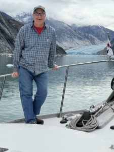
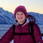
Stu Smith enjoying a recent trip outside the Tracy Arm-Fords Terror Wilderness in SE Alaska

Growing up in rural Oregon as the son of a forester, Stu knew he was destined for a career involving the outdoors and natural resources. From an early age he studied the maps and aerial photographs his dad would bring home. After working as a wildland firefighter through college, he earned a PhD in plant ecology. At the time GIS, short for Geographic Information System, was in its infancy, but Stu became fascinated with how it could connect his work in ecology collecting field data and analyzing it with statistics with his love for maps. Soon after Stu decided to pursue a career in GIS.

Stu describes GIS as a big map overlaid with transparent sheets showing things like land ownership, soil types, watersheds, and wildlife migration corridors, all georeferenced, or lined up with the map and each other. These sheets can be viewed in any combination to see how they intersect, and even how they change over time.

For our inventory purposes, we needed to collect and organize the electronic data layers of designated wilderness areas, proposed wilderness areas and other relevant conservation designations, as well as private properties in and around them. It sounds simple enough, but with 180,000,000 land ownership parcels recorded by 3,200 counties across the US (each with its own slightly different method of keeping and naming records), it is no easy task. When you think about all the different combinations and permutations of how these parcel layers can intersect, the possibilities quickly multiply. That is where Stu stepped in. Volunteering his time, he expertly crafted the algorithms to have the GIS software identify private inholdings within wilderness, edgeholdings that adjoin wilderness, and outholdings that may be important for protecting wilderness values. Essentially this created the first-ever complete national inventory.

Now we are hard at work ground-truthing it to refine those algorithms. Where are the boundaries shown by different data sources in conflict? Of the inholdings identified, which are privately owned vs. state or tribally owned? Which are owned by other land trusts or conservation groups? Which counties are recording things like grazing leases on public lands in the same way as private ownership? Our partners around the country are applying their local knowledge to help us with this work, as well as to provide GIS layers for proposed wilderness or other conservation priorities. With each step of this process, our inventory becomes more refined, and the full picture of the need and opportunity for protecting private lands in and around wilderness comes into sharper focus.

This screenshot taken from our GIS mapping tool shows how we can easily identify wilderness inholdings that are entirely within the wilderness (red), as well as edgeholdings that are partially within or adjoining the wilderness (purple). It also identifies properties not within or adjoining the wilderness (yellow) for which protection might benefit wilderness values. The tool also allows us to easily identify ownership– in this case these properties are owned by the Trust, and are part of our 183-acre Cross Mountain project in Colorado which will soon be transferred to public ownership.

Already this tool is providing huge benefits to our work. In the coming months, we’ll continue to refine it and build the additional capacity in it to analyze parcels for various development threats and conservation values using local, regional, and national data layers. Soon we look forward to making it available to share with land management agencies and other conservation organizations to aid in their work as well.

Beyond the many many hours of his time he has donated, Stu’s vision and discerning eye have brought immense value to the project, and we are beyond grateful. For his part, Stu says “I’m just happy to be the right person at the right time to be able to help the Trust”.

The initial investment to build our GIS program over the next three years will require $200,000 in capital, with an ongoing annual cost of $52,000. Donate today to support this work.
 

Get more wilderness news delivered to your inbox!

Select list(s) to subscribe to


By submitting this form, you are consenting to receive marketing emails from: The Wilderness Land Trust, PO Box 881, Helena, MT, 59624, https://www.wildernesslandtrust.org. You can revoke your consent to receive emails at any time by using the SafeUnsubscribe® link, found at the bottom of every email. Emails are serviced by Constant Contact
Share this entry
  • Share on Facebook
  • Share on X
  • Share by Mail
https://wildernesslandtrust.org/wp-content/uploads/2024/07/Screenshot-2024-07-12-at-8.52.54 AM.png 1304 2916 Margosia Jadkowski https://wildernesslandtrust.org/wp-content/uploads/2024/12/wilderness-land-trust-logo-2024.png Margosia Jadkowski2024-07-15 09:29:042024-07-15 09:29:04Mapping threats to the wilderness you love
You might also like
Colorado Land Protected for Future Wilderness
Sally Bowman Joins the Weminuche Wilderness
We’re Applying for Land Trust Accreditation Renewal
Snowy Little Castle Lake Protecting Access to Castle Crags Wilderness
Santa Lucia Flower California Condor Trail Access is Permanently Protected
Readying a Property for Transfer
Looking east from the Grandview Lode property The Romance of Heart Lake
Saying Goodbye to a Conservation Leader

Join Us

Get more wilderness news delivered to your inbox!

Select list(s) to subscribe to


By submitting this form, you are consenting to receive marketing emails from: The Wilderness Land Trust, PO Box 881, Helena, MT, 59624, https://www.wildernesslandtrust.org. You can revoke your consent to receive emails at any time by using the SafeUnsubscribe® link, found at the bottom of every email. Emails are serviced by Constant Contact

Recent News

  • What we can learn from the Roadless Rule public comments
  • Catching up with an old friend: Old Woman Mountains Wilderness
  • Protecting a haven for endangered wildlife in Southern California
  • One step closer to wilderness for Snowmass Falls Ranch
  • What the Roadless Rule means for wilderness
61 acres, permanently protected. The Great Western 61 acres, permanently protected. The Great Western Lode and Needle Creek properties have been added to the Weminuche Wilderness, ensuring they’ll stay wild forever. When you give where you live through Colorado Gives day, your support fuels this work. Donate now through December 8th.
7,373 acres protected across Colorado and counting 7,373 acres protected across Colorado and counting! Give where you live, and help us continue to protect the wilderness you love this Colorado Gives Day. Early giving is now open through the link in our bio!
Over 1 million people participated in the public c Over 1 million people participated in the public comment period for the proposed rescission of the Roadless Area Conservation Rule, with 390,000 submissions and 81,000 unique comments.
 
We can learn a lot from them. We know that 97% of them opposed rescinding the Roadless Rule, and that the top topics mentioned in them were environmental protection and biodiversity; recreation, tourism, and public use; water quality and quantity; wildlife habitat; and forest management and wildfire.
 
But what was most striking when reading through comments was what the arguments were built on. They speak about experiences in these places, shared across generations, and the impact they have had on people from all walks of life. They reflect heritage and traditions passed down through families and cultures. They hold a remarkable amount of hope and continued trust in a shared vision for the future of our planet. They value the common good over the profit of the few. They speak up for all life, not just human life. They trust in science. They revere beauty and something greater than ourselves. 
 
We can also learn a great deal from comments in favor of opening up roadless areas. While some represent industry interests, many come from people with a deep connection to these lands. Some share the experiences of people with disabilities who are limited in how they can access public lands. Some point to communities, many of them Native, who rely on these lands for subsistence uses and rural economies. Others reflect the fears of communities increasingly impacted by wildfires. All of these voices should be welcomed and represented in decision-making for our public lands.
 
While it’s yet to be seen how these comments will be reflected in the fate of the Roadless Rule, they’ve provided an important opportunity for us to take a moment to listen to our neighbors and better understand our community.
We need your help to protect Robinson Creek! In We need your help to protect Robinson Creek!
 
In California’s Eastern Sierra, the Hoover Wilderness is a spectacular and rugged landscape of alpine lakes, blooming meadows, and granite spires and domes. The Robinson Creek property sits in its heart, overlooking to popular Robinson Creek Tail which leads hunters, anglers, and sportsmen in to the wilderness and neighboring Yosemite National Park. 
 
Your generous contribution will help us raise the remaining $21,750 needed to complete the project and protect the Robinson Creek property as wilderness. 

Donate today through the link in our bio.
With the Agua Blanca property now safeguarded from With the Agua Blanca property now safeguarded from development, we’re helping to protect watersheds and connected habitat for wildlife, and ensure future generations have the opportunity to experience wilderness solitude and inspiration.
A black bear joined Trust supporters in the Roarin A black bear joined Trust supporters in the Roaring Fork Valley of Colorado yesterday to hear about our work protecting local wilderness areas.
Follow on Instagram

Find us on Facebook!

X Logo X Logo Followon X
  • About
  • How We Work
  • News
  • Get Involved

THE WILDERNESS LAND TRUST
PO BOX 881
HELENA, MT 59624

PHONE: 206.397.5240

EIN 84-1192823

Stay Connected

Select list(s) to subscribe to


By submitting this form, you are consenting to receive marketing emails from: The Wilderness Land Trust, PO Box 881, Helena, MT, 59624, https://www.wildernesslandtrust.org. You can revoke your consent to receive emails at any time by using the SafeUnsubscribe® link, found at the bottom of every email. Emails are serviced by Constant Contact
© Copyright Wilderness Land Trust 2018
  • Terms of Use
  • Privacy Policy
Link to: Summer 2024 Wilderness Book Club Pick Link to: Summer 2024 Wilderness Book Club Pick Summer 2024 Wilderness Book Club Pick Link to: Wilderness and the lungs of the planet Link to: Wilderness and the lungs of the planet Wilderness and the lungs of the planet
Scroll to top Scroll to top Scroll to top
Give Now

Donate